Quick links: WebGIS, Aamcho CFR
WHAT IS CFR POTENTIAL MAPPING ?
- CFR Potential Mapping identifies forest areas that communities can manage under India's Forest Rights Act (FRA) of 2006.
- It empowers local Gram Sabhas to sustainably manage forests, promoting community-led governance.
- The process fills critical data gaps, enabling focused implementation and accountability.
HOW IS CFR POTENTIAL ESTIMATED ?
Two key data sources are used:
- Village-based Forest Data
- Villages with over 10 hectares of forest land (as per Census data) are flagged for potential CFR rights.
- This establishes a baseline for areas eligible for claims.
- Reserved Forest Adjacency
- A 2 km buffer into Reserved Forests (RF) is added for villages near RFs, reflecting traditional forest use.
- This method captures additional eligible areas not recorded in revenue boundaries.
By combining these datasets, a comprehensive map of CFR-eligible villages is created, ready for validation.
HOW DOES GIS SUPPORT CFR MAPPING ?
GIS (Geographic Information System) technology refines and visualizes estimates through :
- Digitizing Village Boundaries : Shapefiles of boundaries are corrected and linked to Census data.
- Integrating Land-Use Data : Forest areas from census tables are tied to corresponding village polygons.
- Buffer Mapping : A 2 km inward buffer is drawn into RFs to estimate forest areas likely under community use.
WHY IS CFR POTENTIAL MAPPING IMPORTANT?
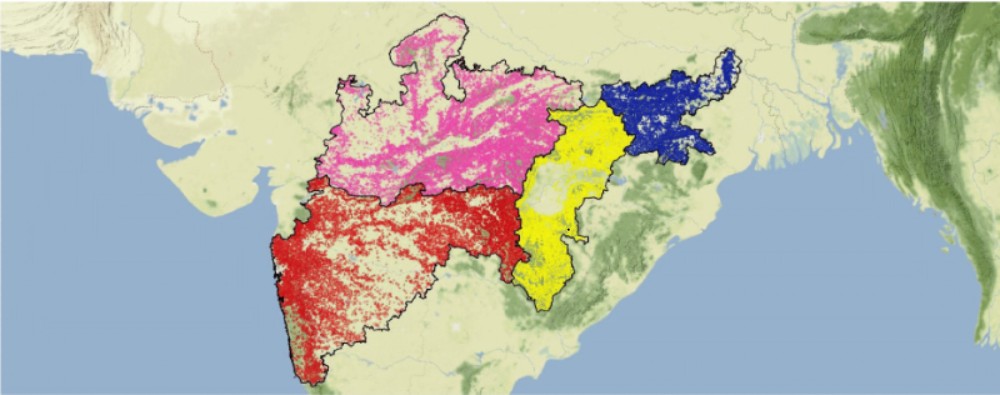
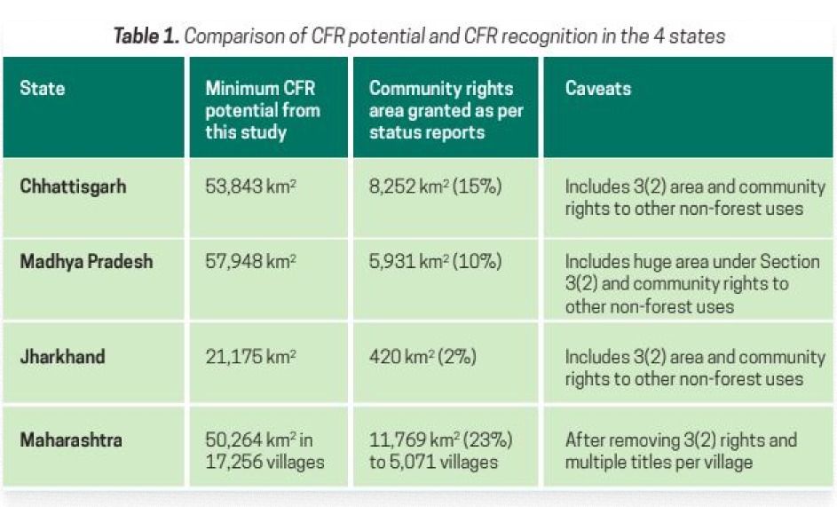
- Applied across states like Madhya Pradesh, Chhattisgarh, Jharkhand, and Maharashtra, it revealed vast CFR potential.
- It supports sustainable livelihoods for millions of forest-dwellers by unlocking community forest governance.
- It supports sustainable livelihoods for millions of forest-dwellers by unlocking community forest governance.
CFR Mapping is a step toward equitable forest management and a stronger community-led conservation future.